December 8, 2021 – Mount Shasta via Avalanche Gulch via Horse Camp
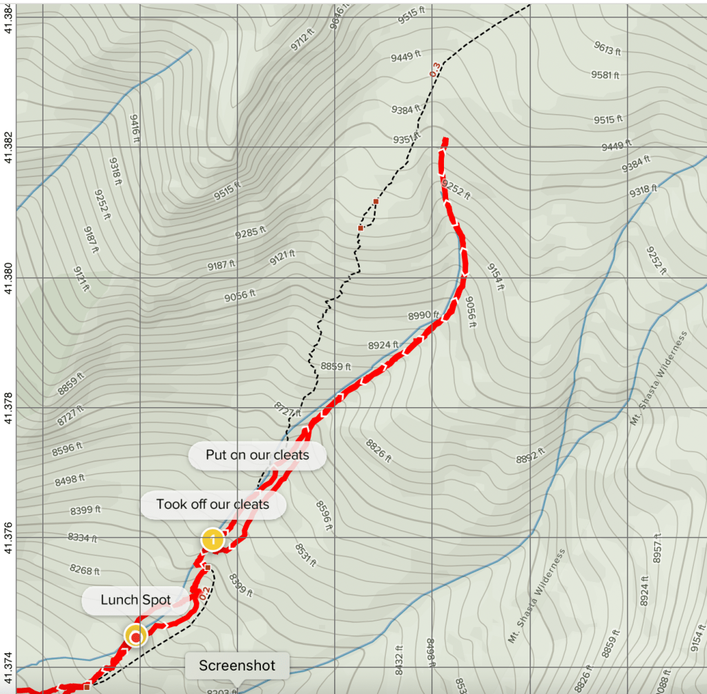
View Route Details: AllTrails Map of our Route
Parking Fees: None for day use. (If summiting you do have to register for a permit.)
Heads up: Long intro on this hike. If you just want to see pretty pics and skip the dramatic opener then just scroll on down past the first 6 paragraphs. =)
I don’t know if you’ve ever seen an adult throw an adult-sized temper tantrum. And by adult I mean a 41-year-old woman. But David got to witness one as I lay faced down on our motel room’s king-sized bed sobbing tears of anguish and then exclaiming in a very dramatic and distraught tone, “I can’t go out there and hike like this! I give up.” (And apparently, I was very convincing cause he totally thought we were gonna stay in because later that day he complimented me on how good of a hike day we had.)
I have been battling cold and flu symptoms (no, not Covid) since Black Friday and each morning I have woken up with this awful and relentless dry cough followed by, well, sorry, but disgusting mucus. I’d wake up gasping for air feeling like I couldn’t breathe. Then as soon as my body would realize, “oh she’s awake!”, it would then send me into nonstop fits of gut wrenching coughing seizures. By the time the attacks were over it felt like I was leaking out of my eyes, nose, and ears.
So, I lay there, face down, giving up, acting like a 2-year-old. I tend to do this at times—it’s not pretty—but it somehow works for me (just not for those near me). Maybe I like spiraling into the deep depths of total and complete despair then feeling triumphant as I climb back up to the top and push past limits and then get to go, “Ta-Da! I hiked the darned mountain in spite of my damned lungs. AND! Had fun doing it.” (The boring psych 101 explanation I have is that I was raised by a strict sets of rules as a kid and my parents had high expectations for me to be perfect. So, when things aren’t so. Well, I basically don’t know how to deal and I spin out of control. Then somehow I always pick myself back up. Poor David has learned to let me be during these times. Comforting me seems to make it worse—probably cause I feel guilty cause I know I’m being totally ridiculous.)
So, there you have it, the not so picture-perfect start to our day. But get some breakfast in my belly and hear the feared words of David telling me, “we can stay here,” and that sure put a fire under my buttocks to get the heck out there and hike. Also, I popped every piece of medication we had on hand just shy of overdosing.
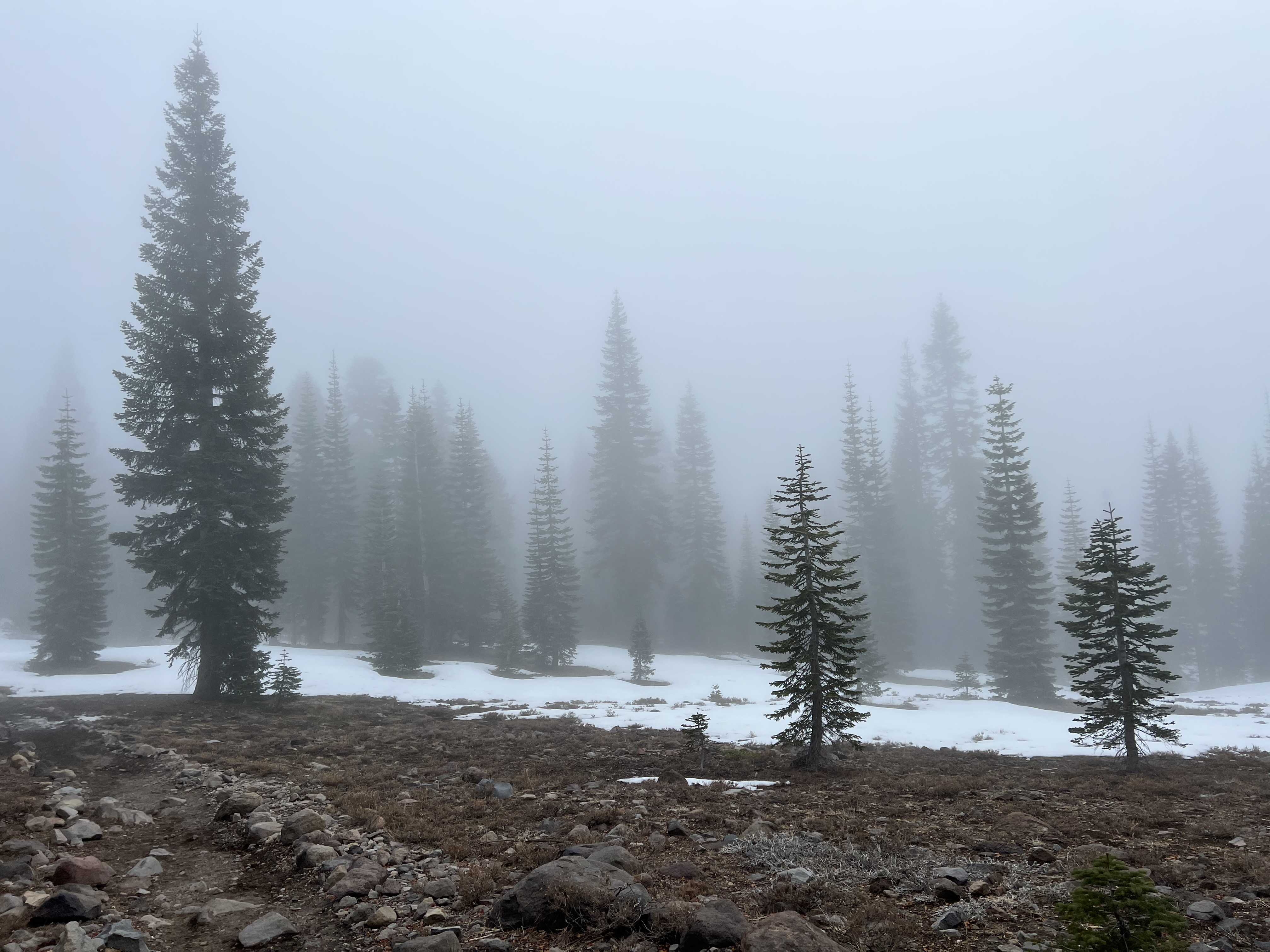
The town of Mount Shasta was completely socked in with fog and clouds and everything looked quite wet. You simply couldn’t see the mountain. The night prior, poor David had his own meltdown about selecting a hike for us. By morning it was a rather simple decision for me on where to go: can’t see the mountain, so let’s go step on it! Plus, I’ve never been on it—my three previous hikes in the area took me away from it and had me looking at Mt. Shasta from a distance. Before we set out we stopped at the Ranger Station which turned out to be closed, but there was a number we could call. The Ranger said that hiking at Castle Crags would be best. Definitely not Black Butte cause of slippery rocks and he didn’t seem to think hiking the trails on Mt. Shasta would be worth it. But I’m a rebel and I did not listen to the Ranger (not that I didn’t value his advice and recommendations). I simply wanted to set foot on Mt. Shasta! David was not about to risk another temper tantrum so we took off to the Bunny Flat trailhead.
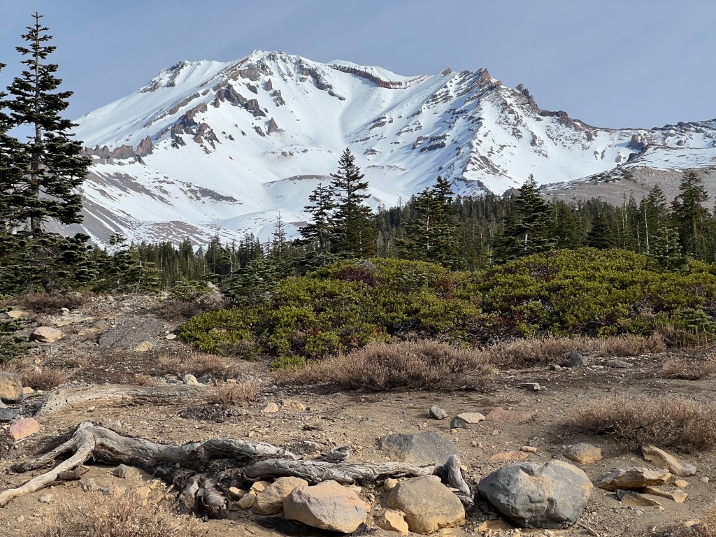
Turned out following my gut decision to just hike on Mount Shasta resulted in the biggest reward. A gorgeous, up close, and full view of the mountain! Photo was snapped right out of the Bunny Flat parking lot and trailhead. Boom! Take that Ranger (again, info provided was much appreciated). I took it knowing that by the time we return from our hike the blue skies will just be a distant memory of the day. (Note: During winter season they close the road at this trailhead, but summer you can drive further up the road to get closer access to the trailhead to Green Butte.)
We headed out toward Horse Camp thinking that would be about as far as we’d likely make it. We packed our cleats, but weren’t in the mood for snowshoeing and I didn’t want to push my luck by overexerting myself.

Next two photos obviously weren’t taken at the exact same spot. That would have required some planning—mental note made for future photo ops now that I know about this cool web feature. But both photos were taken in spots fairly close to each other. Makes a big difference to set out early in the morning. Also, perfect example that when hiking you should always prepare for all types of weather conditions.

(The pictures scroll.)


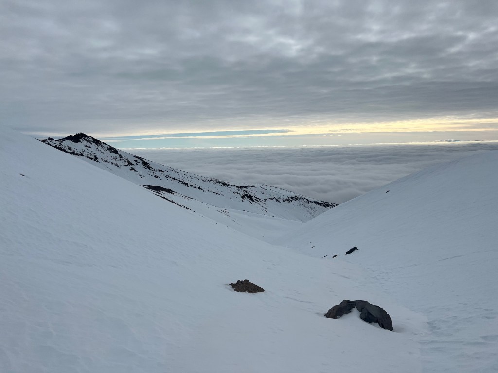
David tells me that those summiting go up the slope to the right of the “heart” then a slow slog up to the left which is Misery Hill then above, over, and beyond is the summit of Shasta.
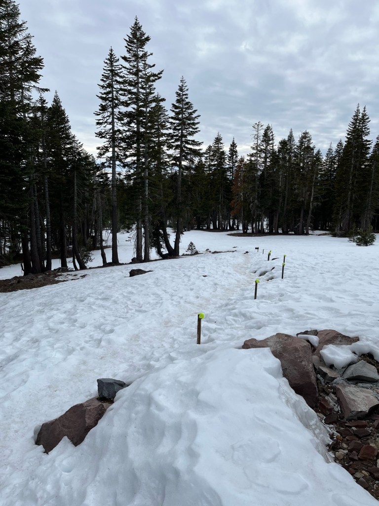
Arriving at Horse Camp we realized it felt like we’d hardly hiked at all cause the trail conditions were so fantastic. So, of course, we pushed on and hiked further up the mountain as tennis balls marked our path.
As per Holly Weiler with Washington Trails Association, the tennis balls are used so that people don’t impale themselves on the chain posts.
The tennis balls then retire at Antoine Peak, Spokane Valley, WA. You can check out Holly’s stories at https://www.instagram.com/e_wa_trails/ and fact check me. =) [Note, yes, some parts of this paragraph were not entirely factual, but Holly did find 3/4ths of an old tennis ball on her hike at Antoine Peak.]
David came upon a sea-far-ing (being far from the sea) seahorse just above Horse Camp.

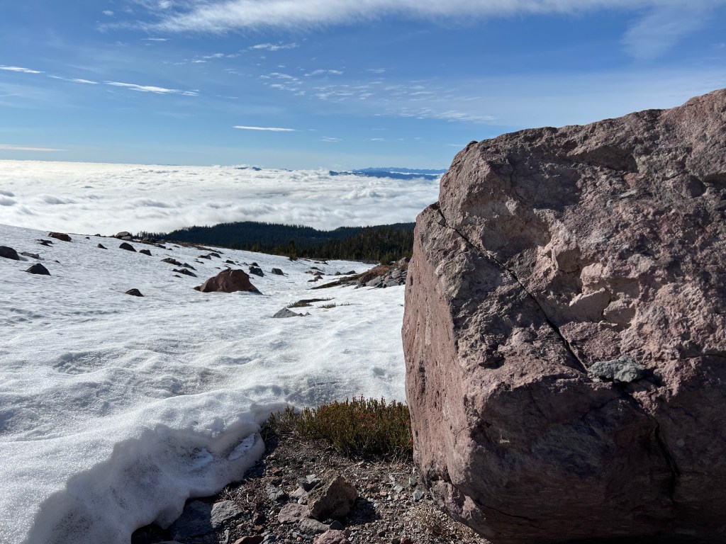
We no longer pick lunch spots by halfway points of our destination. We pick it based on, “hey, is your tummy grumbling, cause mine is.” And also by, “I’m pooped, let’s sit and lunch.” This time around it was a combo of hunger, pooped, and the wind picked up and we didn’t see better shelter further up ahead than this big boulder.

I still had a partial view from behind the boulder.
We’ve learned to not take pics before eating cause then we’re just hangry, but I still haven’t learned to time it to not take pics while David still has food in his mouth. Apparently, that’s why he’s “just” smiling. My answer to this is, “David, eat faster!”

Me taking pics while David is eating. Still.
David: “What? Who me? Still eating? But of course!”

Back on the trail we go! It was more on-snow and then off-snow trail finding.
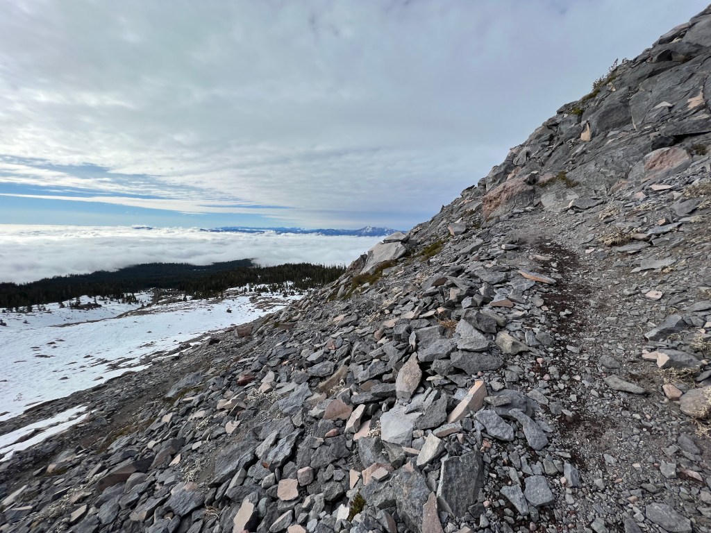
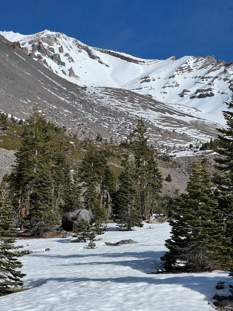
We decided to put on our cleats and get off trail cause the trail was 3/4ths covered in iced up snow and our feet were punching through at times and we had to side hill it and in winter, it’s okay to step off the trail and onto snow. It also happened to be okay to just walk right up up an avalanche alley. Thankfully (but sadly), due to low snow conditions the avalanche danger was low. The snow was well compacted and had a frozen crust that the cleats dug into perfectly. So, up the valley we went staying mostly parallel to the trail.
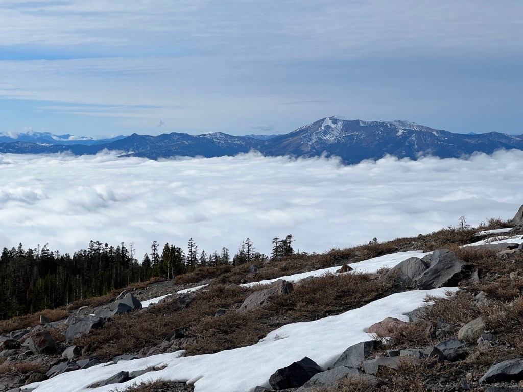
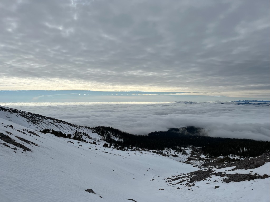
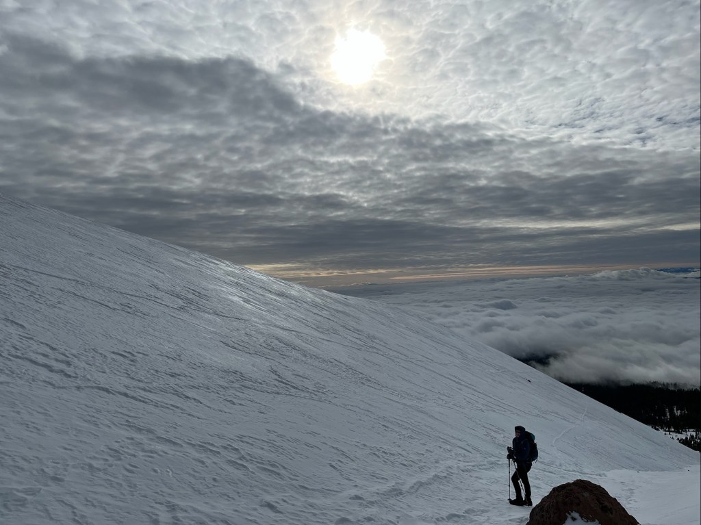
The views were simply fantastic. The clouds below kept inching up higher and higher and we were keeping a close eye on them. We were in this super cool pocket of clouds—basically, we were in a cloud sandwich. Sunset may have been amazing if that sliver of sky stayed open and the sun dropped into it. We don’t mind hiking in the dark, but didn’t want to do trail finding in dense fog and it was still a good 3 more hours until sunset so we didn’t stick around to find out.
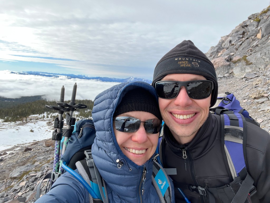
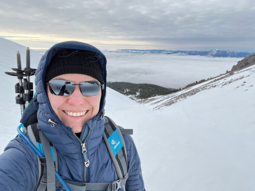
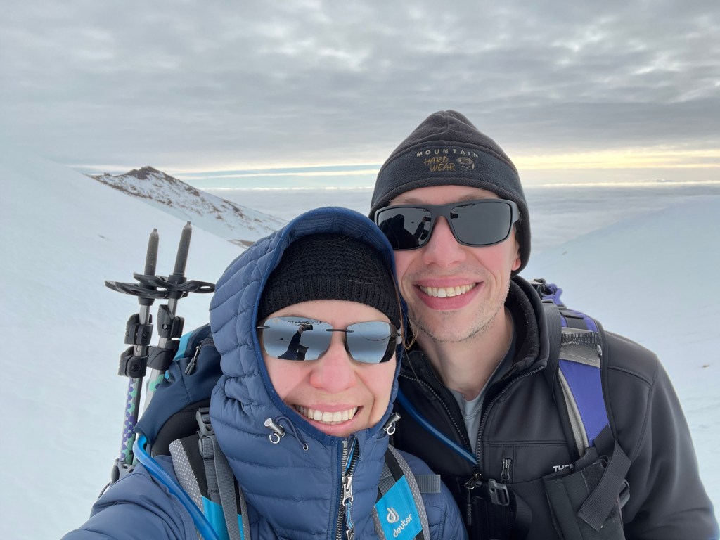
No fake smiles here. That morning fit of frustration melted away with the higher altitude. My heart was definitely working overtime and I could feel it pumping hard in my chest, but the coughing subsided cause I think my lungs were simply too busy taking in gulps of oxygen.
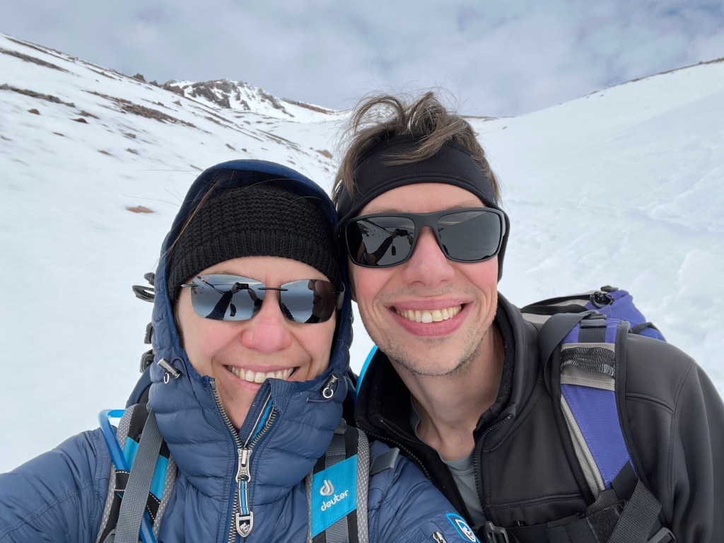
When your husband has a girlier hairdo than your own. Envious. David prefers we compliment him on his old school rocker hairdo.
Stretch–nap time. Surprisingly this was a very warm rock so I hung out for a while, while David used nature’s bathroom. And then apparently also took pics of me. Hopefully, not at the same time. [David’s note: the actual story is that I was standing, uncomfortably perched on a steep slope, waiting to take a picture of Agnes at just the right angle, with the clouds behind her. She refused to get into place, and instead just slumped over on this rock.]
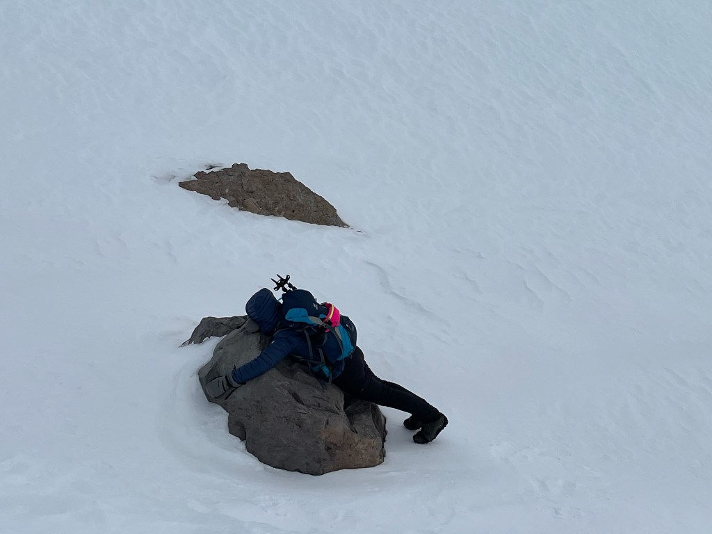
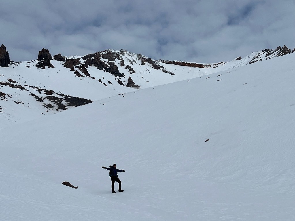
Also, the rock gave me magical powers and I sprinted up the mountain past 9,350 feet of elevation. This video was sadly not shot in slow motion.
Celebrating my victory of SKS—Shortest Known Sprint—at the highest altitude.
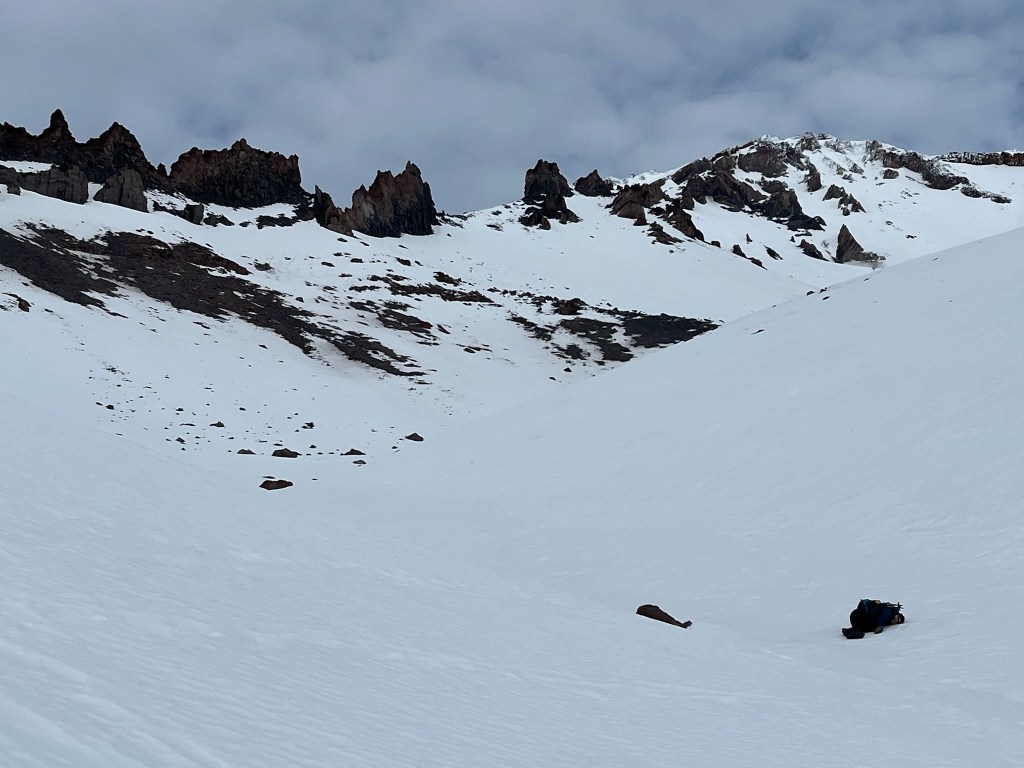
Me, as the reality of my situation sinks in.

Me: Dead. (That clump on the right is not a rock.)
Reunited with my cutie at slightly lower elevation where my sanity is restored.
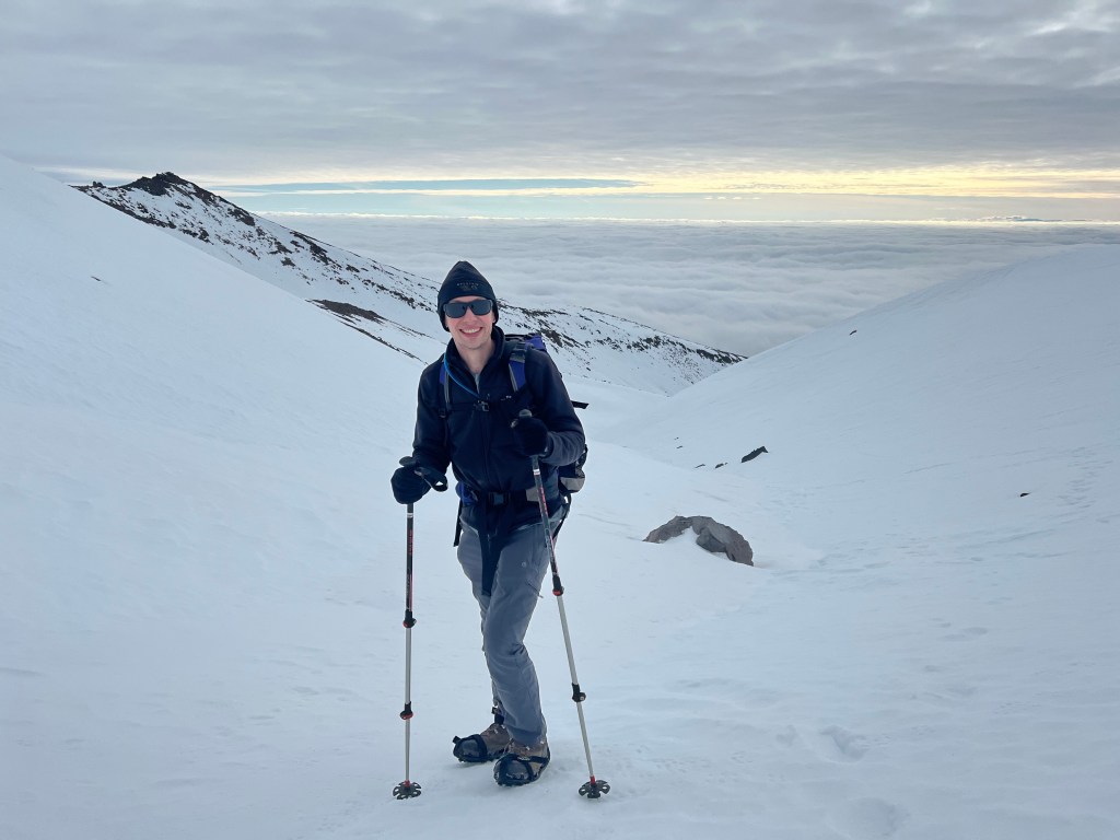
As we say our final goodbye to Mount Shasta and another amazing hike day.
Like. Seriously. The view.
Lingering just a tad bit longer…
Down and down we go. Also, David got to have his photo moment of me with the clouds. Except. This time facing the clouds on the way down.

David has summited Mount Shasta before and he truly thinks I should and could do it. He’s had this thought since 2015 when I first visited the Shasta area without him. I dunno… maybe… I still get worried for the lack of use of my hands in cold weather. Whether to summit it or not I definitely want to visit Mt. Shasta again and again.
Oh, and David called the Ranger Station to report the trail conditions to them should others wish to go hike the trails at foot of Mt. Shasta.
